| 6 albums, 107 images on 2 pages |
|
|
|
|
 |
 |
 |
|
|
This class was sponsored by Dr. Bob Williams with the Rivers Project and TOPS and it was held at Southern Illinois University at Edwardsville, Illinois. SIU hosted this one-day session called INTO TO GIS & GPS TECHNOLOGY FOR TEACHERS. The session was designed for teachers to learn more about Geographical Information Systems (GIS) and Global Positioning Systems (GPS), as well as how to use and teach them. The teachers developed a working knowledge of GIS and GPS, experienced Internet interactive GIS applications, and had an in depth introduction to ArcVoyager software. Then, in the field, they had the opportunity to work with a GPS unit, collect date and see how these tools, GIS and GPS, can be used with students.
The classes lasted only one day but the teachers who were involved had a great time learning these new tools. The teachers learned how to create maps from their local county data and collect GPS data.
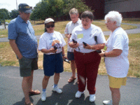
Here are some of the pictures that were taken during the training session. The weather was great and the teachers enjoyed the fieldwork. We also had the opportunity to visit the Coast Guard on the Mississippi River to see how they are using GPS and GIS as related to the depths of the Mississippi River and modeling the river and its currents. Click on any picture for a larger image of the grounds, the coast guard site and the teachers hard at work learning these new technologies.
Last changed on 10/29/05. This album contains 15 items.
This album has been viewed 10031 times since 10/29/05.
|
|
 |
 |
 |
|
|
The Illinois GIS Association sponsored a free half-day workshop to teachers
in the K-12 classrooms and college students who are in an educational program to learn about
GIS & GPS and how these technologies can be incorporated into the classroom.
Last changed on 10/29/05. This album contains 18 items.
This album has been viewed 11759 times since 10/29/05.
|
|
 |
 |
 |
|
|
Our class at Trees for Tomorrow was another exciting class we had the opportunity to teach. It consisted of 18 teachers from all parts of Wisconsin. Trees for Tomorrow is an independent, nonprofit natural resource specialty school which uses a combination of field studies and classroom presentations to teach conservation values as well as demonstrate the benefits of contemporary resource management. In addition to student workshops offered during the school year, TFT hosts teacher workshops during the summer. Trees for Tomorrow is located in Eagle River, Wisconsin.
The classes lasted three days and all involved had a great time learning these new tools. In teaching these classes, not only the students learned a lot but the trainers also learned different prespectives from the students in ways these technolgies can be used in the classroom. We also found out that the local county offices in Wisconsin are more then happy to help teachers obtain data, maps and assistances in using GIS and GPS in the classroom.
Here are some of the pictures that were taken during the training session. The weather was HOT but the teachers still enjoyed the fieldwork. Click on any picture for a larger image of the grounds, local residents and the teachers hard at work learning these new technologies.
Last changed on 10/29/05. This album contains 14 items.
This album has been viewed 12461 times since 10/29/05.
|
|
 |
 |
 |
|
|
This class was sponsored by the Area III Learning Technology Center and it was held at Roseville, Illinois. The Area III Learning Technology Center (LTC) hosted a four-day course for grades 5-12 math and/or science teachers in GIS (Geographical Information System) and GPS (Global Positioning System) technologies and their application in the classroom. The course provided teachers with information about GIS and GPS, why it is important in education, and ways of implementing this technology into the school curriculum. The first part of the class provided teachers with basic GIS knowledge and how to work with ArcVoyager in the classroom. Hands-on activities, GIS software and GIS data was provided. The second part of the class provided teachers with the basic concepts of GPS, how to use the GPS unit, collect data and then use the results with a GIS application.
The classes lasted four days and all involved had a great time learning these new tools. In this class, we did everything in detail as related to GIS and GPS. The teachers learned how to create maps from their local county data, collect GPS data. download GPS data as well as map it on the maps they created.
Here are some of the pictures that were taken during the training session. Some of the pictures are the actual GPS points teachers selected to map. The weather was great and the teachers enjoyed the fieldwork. Click on any picture for a larger image of the grounds, local town pictures and the teachers hard at work learning these new technologies.
Last changed on 11/05/05. This album contains 24 items.
This album has been viewed 12949 times since 10/29/05.
|
|
 |
 |
 |
|
|
The Illinois GIS Association sponsored a free half-day workshop to teachers
in the K-12 classrooms and college students who are in an educational program to learn about
GIS & GPS and how these technologies can be incorporated into the classroom.
Last changed on 02/11/09. This album contains 18 items.
This album has been viewed 13751 times since 10/29/05.
|
|
|


